
The first major snowfall of the season is officially upon the Tri-State Area, prompting forecasters to issue a Winter Weather Advisory and warnings for hazardous conditions. Residents across New York, New Jersey, and Connecticut are urged to prepare for a potentially messy and dangerous Saturday night into Sunday morning.
The Timeline: When to Expect Snow and Ice
According to the latest projections from the National Weather Service (NWS), the advisory is in effect from 10 p.m. Saturday through 1 p.m. Sunday. This period covers the main event, which is expected to unfold after a brief initial period of rain.
The NWS forecasts a moderate snow accumulation, with the region expected to receive between 1 to 5 inches of snow. The flakes are projected to start falling in earnest around 10 p.m. Saturday and continue steadily through the overnight hours, with the storm expected to taper off by approximately 10 a.m. Sunday.
A Warning for Hazardous Travel and Pedestrian Safety
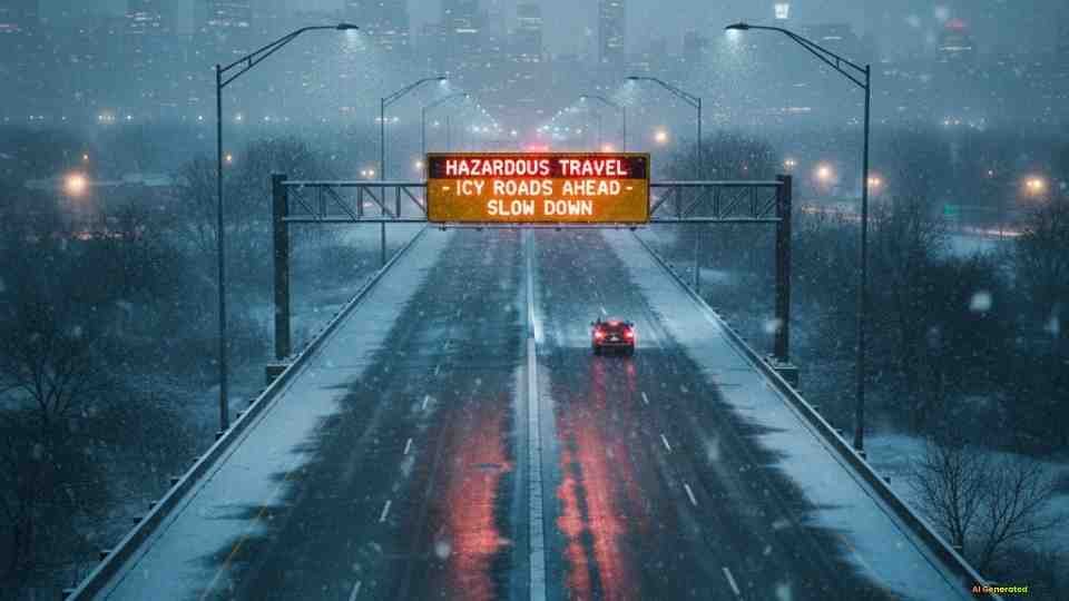
The immediate concern for emergency services and local officials is the dangerous combination of snow and ice the storm will leave behind.
Drivers are strongly advised to exercise extreme caution. Road surfaces, particularly bridges, overpasses, and elevated ramps, are susceptible to freezing quickly and becoming slick. If you must travel late Saturday or early Sunday, slow down significantly and increase your following distance.
Pedestrians must also be vigilant. Sidewalks, stairwells, and driveways are expected to be coated in ice and snow, making slips and falls a high risk. Taking shorter steps and wearing appropriate footwear can make a difference. As your trusted source for regional news, NY Buzz will continue to monitor the conditions and provide the latest updates on school closures and travel impacts.


The Deep Freeze: Brace for Icy Cold
The storm’s impact won’t end when the snow stops. Following the winter event, the Tri-State will be hit by a significant drop in temperatures.
Residents should bundle up to combat frigid daytime temperatures ranging from 22 to 25 degrees Fahrenheit. The most dangerous element, however, will be the wind chill, which is forecast to drop bone-chillingly low, settling between 5 to 15 degrees Fahrenheit. Extended exposure to these wind chills can quickly lead to frostbite.
Actionable Tips for the Tri-State Area
- Secure Your Home: Clear gutters and ensure all necessary winter gear (shovels, salt, flashlights) is easily accessible.
- Safety First: Avoid unnecessary travel. If you must drive, ensure your gas tank is full and your vehicle is properly winterized.
- Check on Neighbors: Take a moment to check on elderly neighbors or those who may have trouble clearing snow or stocking supplies.
This is a developing weather story, and conditions can change rapidly. Please check back for the latest forecasts and safety information.